Researchers launch new Kansas Flood Mapping Dashboard
Phys.org • 11/18/2025

Summary
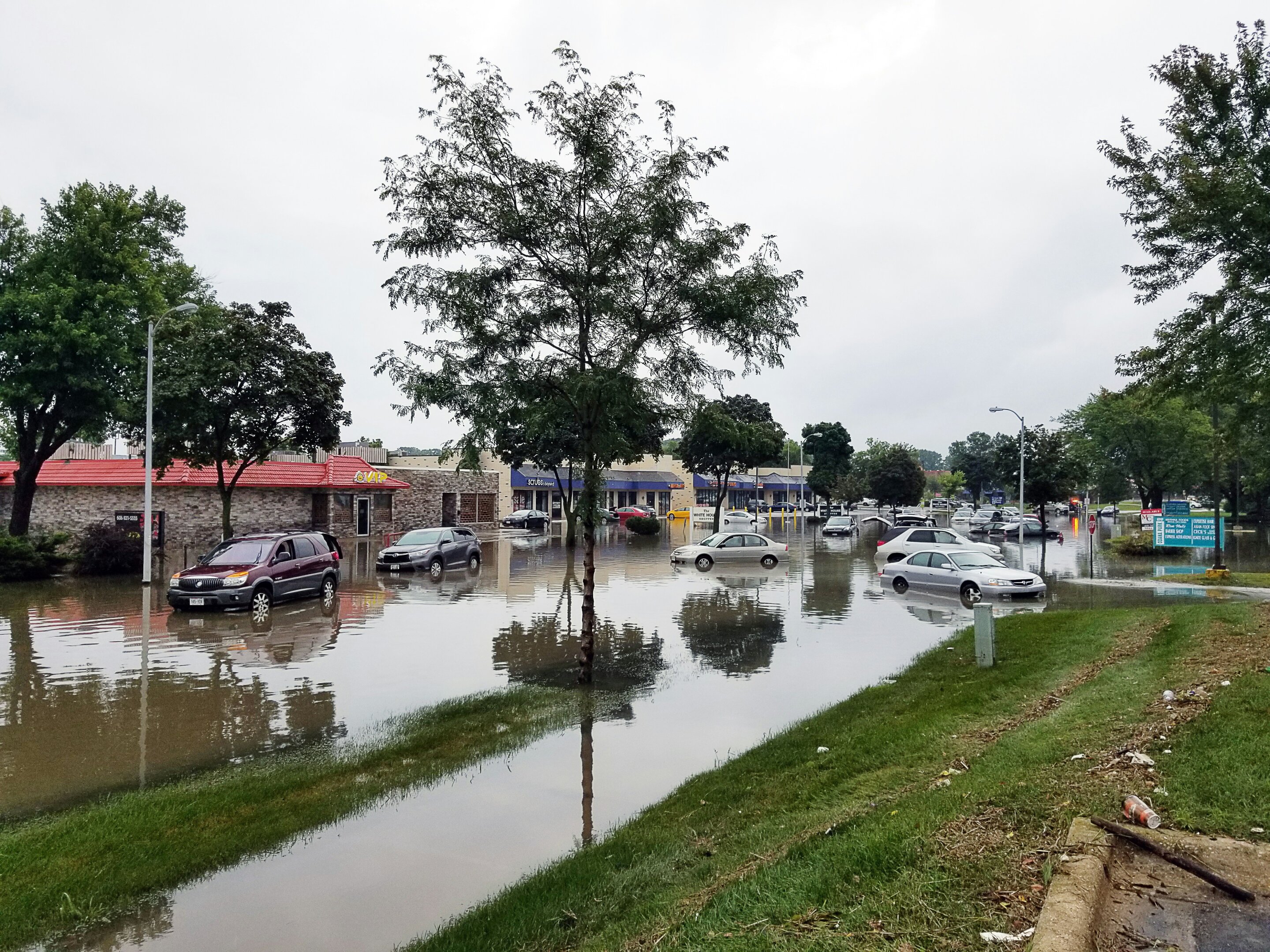
Researchers have launched a new Kansas Flood Mapping Dashboard to enhance understanding and management of flood risks in the state. Jude Kastens noted that while flooding is less severe in northwest Kansas compared to other regions, heavy rainfall can still lead to significant local impacts.
Advertisement
Cluster Activity
1
1
1
2
1
2025-11-182025-11-27
Lindy Score Breakdown (V4.2)
103d
Age
1
Sources
from cluster
2475
Hours Since Seen
Final Score0/100
CategoryAntiLindy
StatusArchived
Recency Multiplier0% (0.5^2475/48)
Hero EligibleNo
Score is 0 because recency decay (0.5^2475/48 = 0.000000) reduced it below 0.5
Story Timeline
- 2025-11-18Researchers launch new Kansas Flood Mapping Dashboard (current)
- 2025-11-24
- 2025-11-25
- 2025-11-26
- 2025-11-27
Score BreakdownRisk 50
Source Reputation: Low-trust source (6/20 pts)
Consensus: Single source - no independent confirmation yet
Age: 103 days - proven survivor
Stories gain Lindy status through source reputation, network consensus, and time survival.
Same Story from 6 sources

Researchers develop novel bathymetric framework for high-accuracy shallow-water mapping
Phys.org • 3+ months

An important wetland in Ghana is under siege. Researchers investigate the real issues
Phys.org • 3+ months

Researchers find smaller amounts of microplastics in southern Narragansett Bay
Phys.org • 3+ months

Researchers propose novel BaTiO₃-based catalyst for oxidative coupling of methane
Phys.org • 3+ months

Researchers model how encapsulation shapes the evolution of living cells
Phys.org • 3+ months
Breaking Similar stories
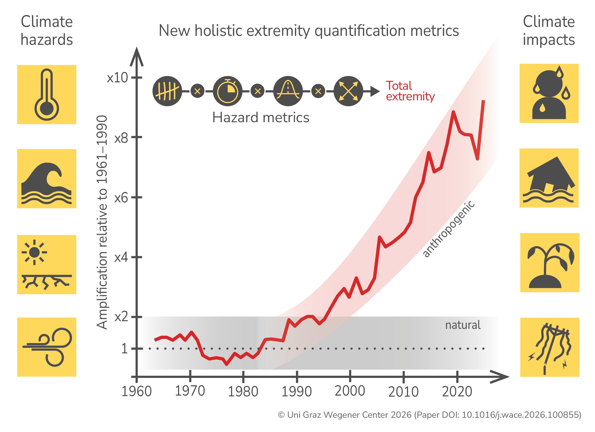
New computation method for climate extremes: Researchers reveal 10-fold increase in heat over Europe
Phys.org • Today
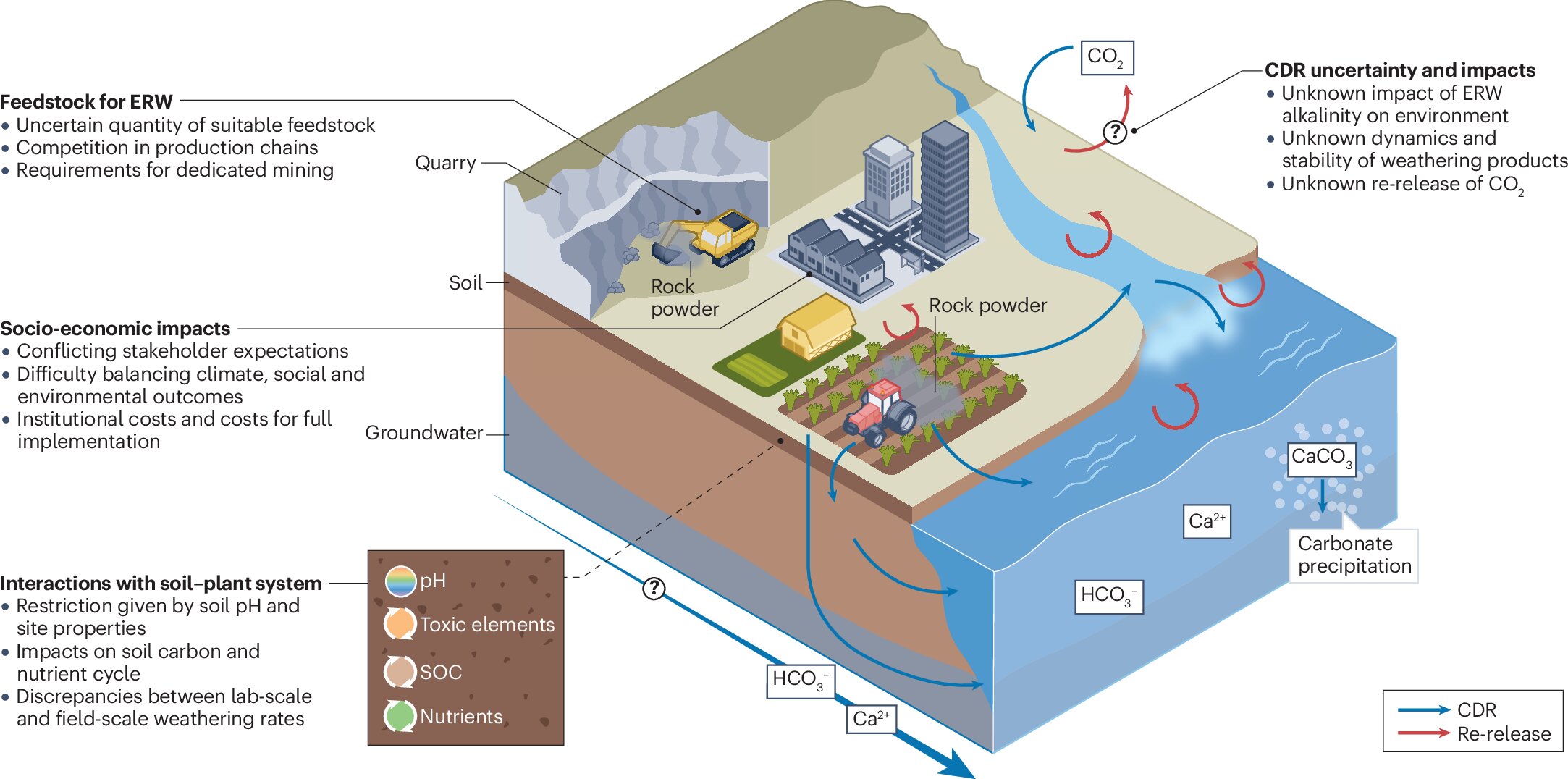
Enhanced rock weathering is not yet a reliable climate protection measure, say researchers
Phys.org • Today
Flood losses often come every five to 20 years; here's how insurance could adapt
Phys.org • 1 day ago
Mapping gene regulation to better control inflammation, immunity and cancer
Phys.org • 1 day ago
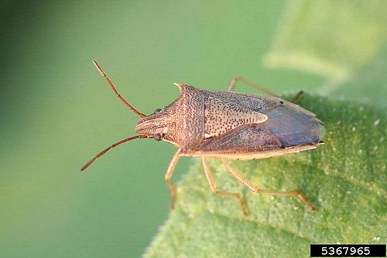
Genetic mapping of rice stink bug aids crop pest control
Phys.org • 1 day ago

Q&A: Researchers discuss potential solutions for the feedback loop affecting scientific publishing
Phys.org • 1 day ago
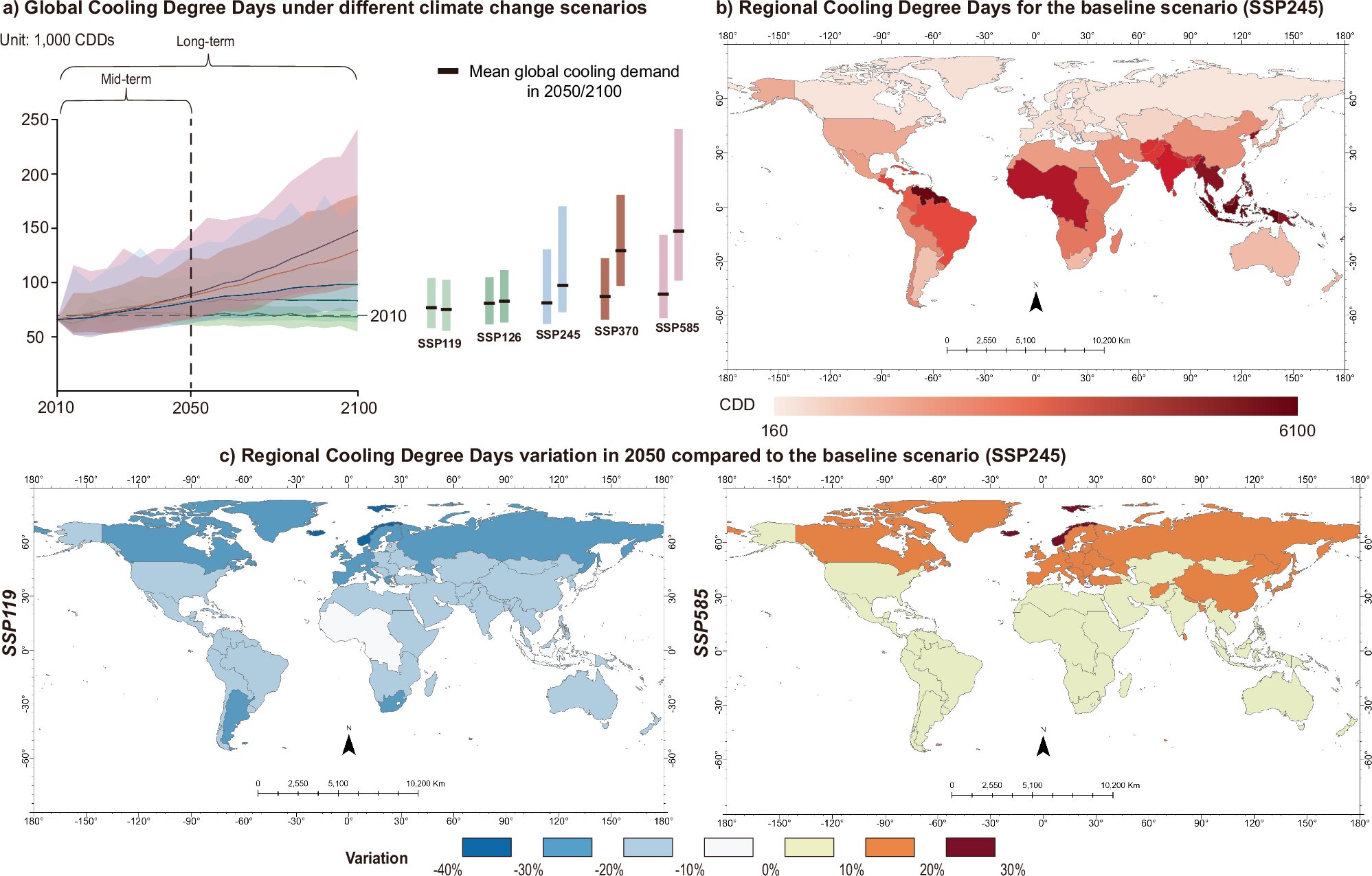
The climate cost of staying cool: How AC could impact global warming by 2050
Phys.org • 1 day ago
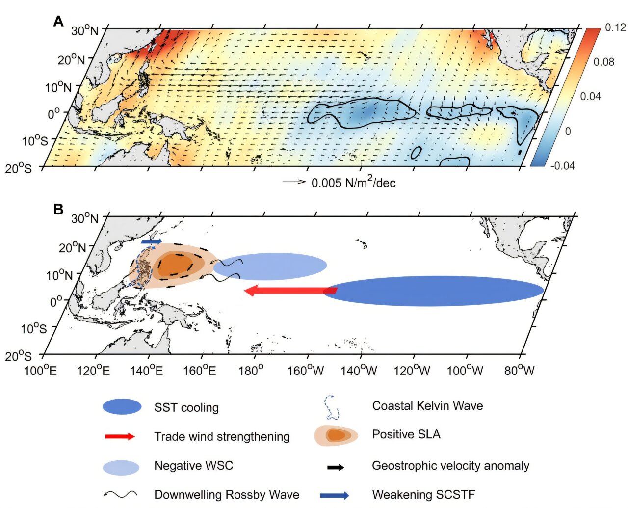
Coral proxy data reveals century-long slowdown of South China Sea throughflow under global warming
Phys.org • 2 days ago
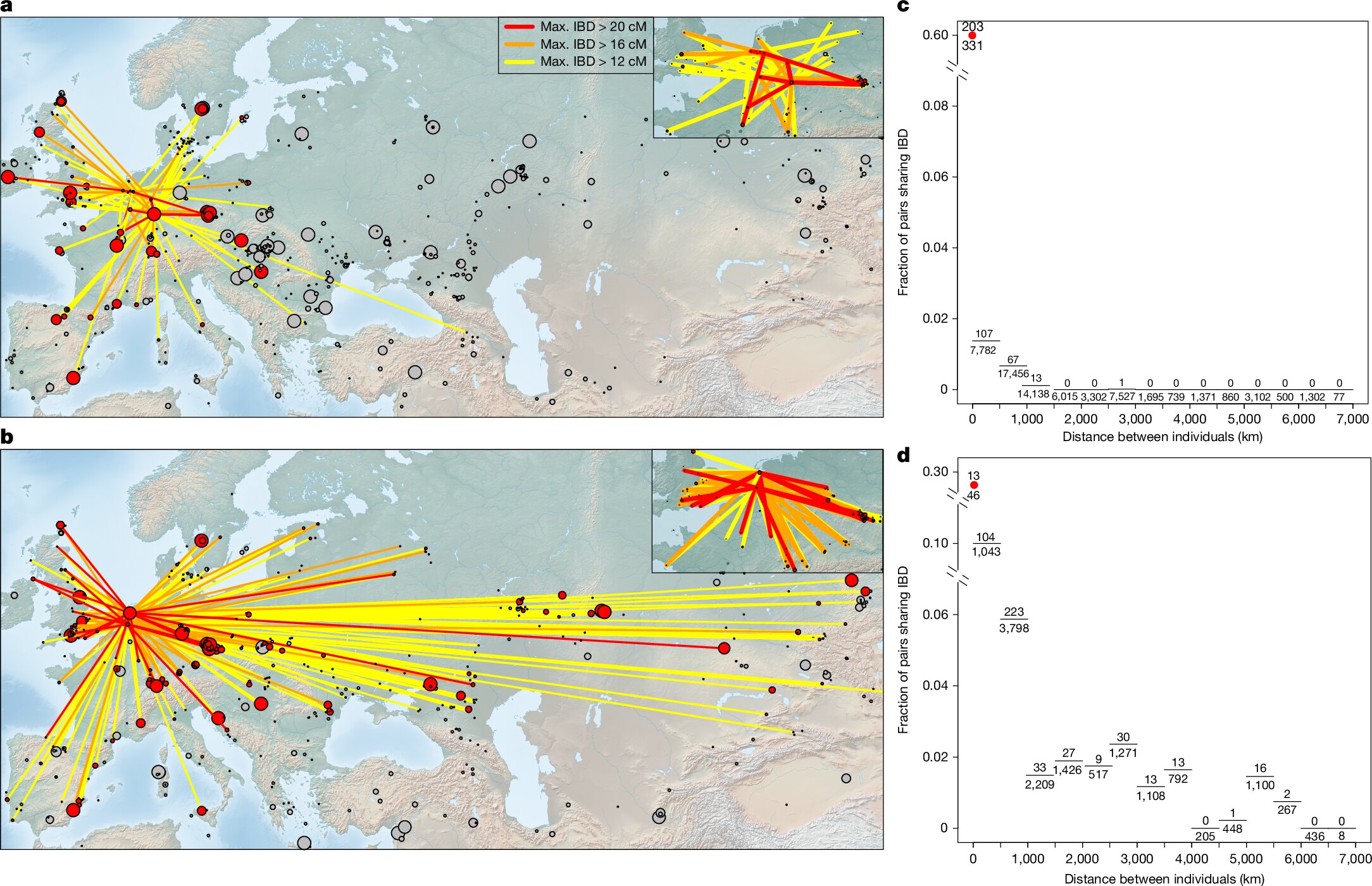
DNA study uncovers continental origins of Britain's Bronze Age population
Phys.org • Today
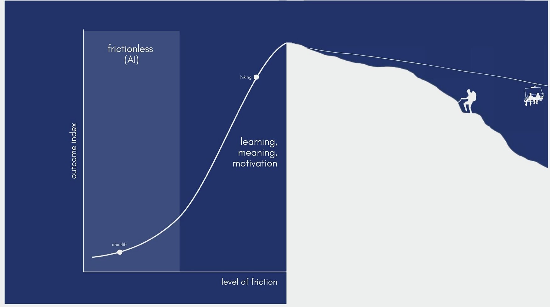
Frictionless AI comes at a human cost to learning, growth and connection
Phys.org • Today
Anti-Lindy Similar stories
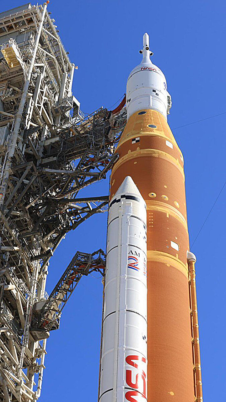
NASA moves its Artemis II moon rocket off the launch pad for more repairs
Phys.org • 4 days ago

Q&A: Why the fall of Mexico's most wanted kingpin matters
Phys.org • 5 days ago

Anthropic’s safety-first AI collides with the Pentagon as Claude expands into autonomous agents
Scientific American • 1 week ago
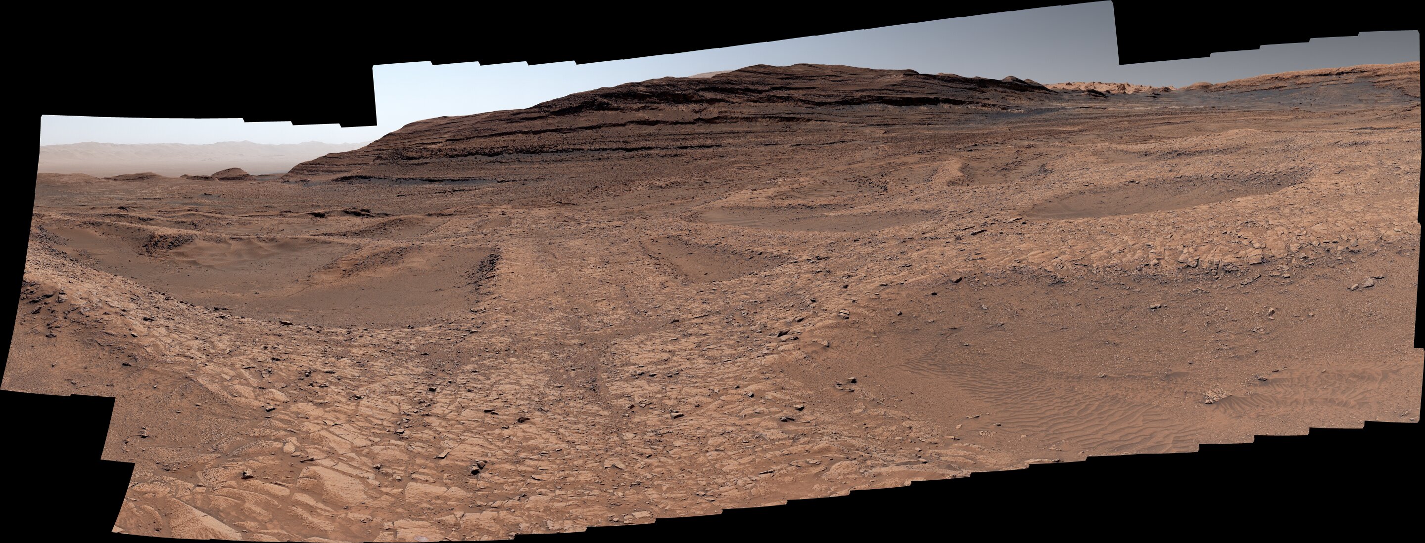
Image: Curiosity rover surveys boxwork region of Mars
Phys.org • 5 days ago